
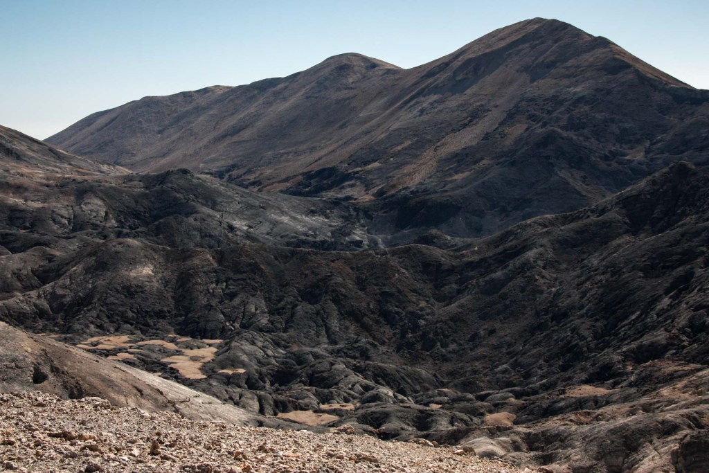
Lefka Ori today are the largest mountain range in Crete, with a highest altitude of 2,453 meters at the peak of Pachnes. They are 30 km long and 25 km wide, with more than 50 peaks over 2,000 meters high. In among the bare peaks are numerous plateaus and areas that sometimes resemble a moon landscape. Elsewhere, huge piles of rocks cover the mountain slopes, which in turn are continuously intersected by impressive gorges, while smaller and larger cave openings lead us to the interior of the rocky mass.
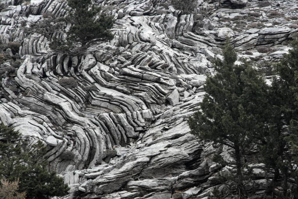
The rocks were created, then, at the bottom of an ancient sea, but how did they go from the bottom of the sea to the crest of a mountain range with an altitude of over 2,400 meters? The answer is to be found in what geologists call plate tectonics. The solid crust of the earth is divided into individual sections, the lithospheric plates, which are not fixed but move constantly at a rate of a few centimeters a year (usually 2-4cm), transforming the earth’s geography. One such plate is the African and another is the Eurasian, close to the boundaries of which Crete is located. These two plates converge, with the result that the African plate began to be subducted under the Eurasian one approximately 60 million years ago. This process continues to take place even today, with the movement of the African plate towards the northeast at a speed of 1 cm a year and Crete (part of the border of the Eurasian plate) towards the southwest at a speed of 3 cm annually (convergence of 4 cm a year). This collision resulted in the creation of the so-called Hellenic arc, which includes Crete
Crete and Lefka Ori were not, however, immediately created as we know them today but through a turbulent geological history of 23 million years. The signs of this history can still be seen today, not only in the rocks but in the island’s wildlife. A series of geological and climatic changes continuously transformed the geography of the Aegean. A section of the bed of the Tethys Sea rose, with the result that 17 million years ago almost all the Aegean was a continuous area of dry land, known as Aegiis. Aegiis, however, was again submerged when the sea flowed in from the south approximately 12 million years ago. Crete then broke up into individual islands (which were essentially the peaks of the low mountains at the time), until an event took place that impacted not only upon the geography but also the formation of the habitats of Crete. Approximately 5.6 million years ago, geological forces blocked the straits of Gibraltar and the Mediterranean was cut off from the Atlantic.

Crete and Lefka Ori were not, however, immediately created as we know them today but through a turbulent geological history of 23 million years. The signs of this history can still be seen today, not only in the rocks but in the island’s wildlife. A series of geological and climatic changes continuously transformed the geography of the Aegean. A section of the bed of the Tethys Sea rose, with the result that 17 million years ago almost all the Aegean was a continuous area of dry land, known as Aegiis. Aegiis, however, was again submerged when the sea flowed in from the south approximately 12 million years ago. Crete then broke up into individual islands (which were essentially the peaks of the low mountains at the time), until an event took place that impacted not only upon the geography but also the formation of the habitats of Crete. Approximately 5.6 million years ago, geological forces blocked the straits of Gibraltar and the Mediterranean was cut off from the Atlantic.
The impressive geomorphology of Lefka Ori is due to two main factors, which have acted simultaneously and in concert. The first factor has already been mentioned and concerns the endogenic forces (collision of lithospheric plates, etc.). The second factor are exogenic forces, which include environmental conditions (action of the water, air, vegetation, etc.) on the surface of the earth. One might of course ask how can all these environmental conditions, such as water and air, have an impact on the hard and resistant rocks. It is indeed true that the rocks of Lefka Ori are not so fragile and with great difficulty can we imagine that weathering by water and air along with the deposits that they transfer are able to shape the relief to such a degree. The reason is to be found in a main feature of these rocks: their high calcium carbonate content. The otherwise resistant rocks are incredibly susceptible to the action of water, which dissolves and transports the calcium carbonate through a process known as karst erosion. This process is due to the dissolving action of the water on the calcium carbonate, even if this contains only a small quantity of acid, something that usually happens when the calcium in the atmosphere is picked up by raindrops. The result of this karst action of the water is the creation of cavities, cracks and other karst forms. At the higher peaks in particular, it has been suggested that both the existence of glaciers in the Pleistocene era and the intense changes in temperature between day and night, which shatter even the hardest rocks, have contributed to the shaping of the geomorphology. The ability of the water to deposit materials at lower levels is yet another factor that has impacted upon the geomorphology of the region, making some areas bare and depositing sediment in others.
